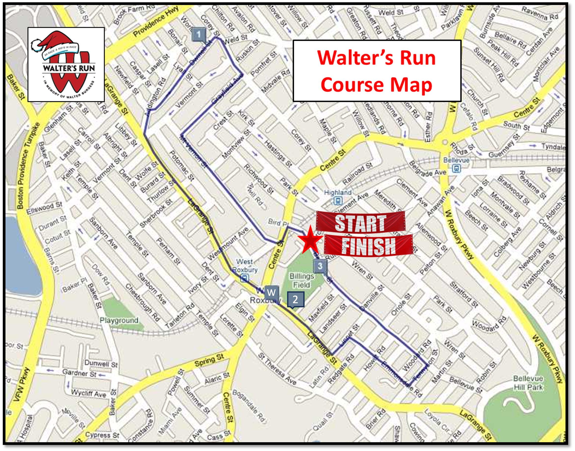
Walter’s Run 5k is a rolling route thru the West Roxbury neighborhood of Boston. Our accurate wheel-measured course is USATF sanctioned. We provide a water stop, mile splits and course security with volunteers and police.
- The race starts on Bellevue Street at the top entrance of the Parkway YMCA.
- Proceed towards Centre Street.
- Left on Centre, quick right on Mt. Vernon.
- Right on Grayfield, left on Corey, left on Dwinell.
- Mile 1 marker is just past the corner of Corey and Dwinell.
- Bear Left on Addington
- Left on LaGrange, cross over Centre Street.
- Water stop located on LaGrange, just past the corner of Lagrange and Centre, at the Billings Field entrance sign.
- Mile 2 marker is just past the water stop, at the Billings Field House.
- Nice uphill on LaGrange.
- Left on Linnet, right on Emmonsdale (uphill again!)
- Left on Tennyson, Left on Bellevue.
- Long, fast downhill finish back at the YMCA!
- Additional details can be found on MapMyRun here — http://www.mapmyrun.com/routes/view/26032064


1 Comment on "Course Map"
[…] Download Image More @ http://www.waltersrun.org […]